Showing posts with label Tide. Show all posts

Tuesday, May 5, 2026

‘Point of no return’: New Orleans relocation must start now due to sea level, study finds. Louisiana’s cultural hotspot could be surrounded by Gulf of Mexico before end of this century, authors say


By


The process of relocating people from New Orleans should start immediately, as the city has reached a “point of no return” that will see it surrounded by the ocean within decades due to the climate crisis, a stark new study has concluded.

Ongoing sea-level rise and the rampant erosion of wetlands in southern Louisiana will swallow up the New Orleans area within a few generations, with the new paper estimating the city “may well be surrounded by the Gulf of Mexico before the end of this century”.

Low-lying southern Louisiana faces multiple threats, with rising sea levels driven by global heating, compounded by strengthening hurricanes, also a feature of the climate crisis, and the gradual subsidence of a coastline that has been carved apart by the oil and gas industry.


Southern Louisiana is facing 3-7 metres of sea-level rise and the loss of three-quarters of its remaining coastal wetlands, which will cause the shoreline “to migrate as much as 100km (62 miles) inland”, thereby stranding New Orleans and Baton Rouge, according to the study, which compared today’s rising global temperatures with a period of similar heat 125,000 years ago that caused a rise in sea level.

This scenario makes the region the “most physically vulnerable coastal zone in the world”, the researchers state, and requires immediate action to prepare a smooth transition for people away from New Orleans, which has a population of about 360,000 people, to safer ground.

Louisiana has already experienced population loss in recent years, and this trend will accelerate in a disordered way, the paper warns, should no action be taken to confront the perils faced by its largest city and surrounding communities.

“While climate mitigation should remain the first step to prevent the worst outcomes, coastal Louisiana has evidently already crossed the point of no return,” added the perspectives paper, published in the Nature Sustainability journal. A perspectives paper is a scholarly article that provides an assessment, rather than new data.

Billions of dollars have been spent to fortify New Orleans with a vast network of levees, floodgates and pumps erected after 2005’s catastrophic Hurricane Katrina. But the growing threats to the city mean the levees, which already require hefty upgrades to remain sufficient, will not be able to save the city in the long run, the new paper warns.


“In paleo-climate terms, New Orleans is gone; the question is how long it has,” said Jesse Keenan, an expert in climate adaptation at Tulane University and one of the paper’s five co-authors.


Keenan said the timeframe available to plan a retreat isn’t certain but “it’s most likely decades rather than centuries”.

“Even if you stopped climate change today, New Orleans’s days are still numbered,” he added. “It will be surrounded by open water, and you can’t keep an island situated below sea level afloat. There’s no amount of money that can do that.”

City, state and federal leaders should begin work to help support people moving away from the New Orleans region in a coordinated way, starting with the most vulnerable communities, such as those in Plaquemines parish who live outside the levee system, Keenan said.

“New Orleans is in a terminal condition, and we need to be clear with the patient that it is terminal,” he said. “There is an opportunity for palliative care, we can transition people and the economy. We can get ahead of this.”

But, he added, “no politician wants to first give this terminal diagnosis. They will speak about it behind closed doors, but never in public.”

New Orleans faces obvious challenges – situated in a bowl-shaped basin below sea level, the city already has 99% of its population at major risk of severe flooding, the worst exposure of any US city according to a separate study released last week.

“Even compared to all other US cities, New Orleans really stands out, which is alarming,” said Wanyun Shao, a co-author of this study and a geographer at the University of Alabama.

“There is no specific timeline to how long New Orleans has left but we know it’s in big trouble. They are facing one of the highest sea level rises in the world and I don’t know how long human effort can fight against that tide. It’s like a timebomb.”

Shao said she concurred that relocation of people would have to take place. “I know it’s a politically and emotionally charged issue, there are people with a deep attachment to New Orleans,” she said. “But managed retreat, no matter how unappealing it may be, is the ultimate solution at some point.”

A major pressure upon this southern cultural hotspot is that its surrounding land is briskly receding. Since the 1930s, Louisiana has lost 2,000 sq miles of land to coastal erosion, equivalent to the size of Delaware, with a further 3,000 sq miles set to vanish over the next 50 years. The rate of land loss is so rapid that a football pitch-sized area is wiped out every 100 minutes.

To help counter this, Louisiana last decade settled upon a new sort of plan that eschewed building yet more flood defenses and instead sought to harness the Mississippi River’s natural ability to rebuild land. Levees and other infrastructure have, until now, straitjacketed the naturally meandering Mississippi and pushed the sediment it carries straight into the Gulf of Mexico, rather than replenish the coastal wetlands.

The so-called Mid-Barataria Sediment Diversion project, which broke ground in 2023, would help restore a more natural flow in the Mississippi Delta and allow sediment to build up in coastal areas where it has been lost. More than 20 sq miles of new land would be created over the next 50 years under the plan, the project estimated.

However, Jeff Landry, Louisiana’s Republican governor, scrapped the project last year, arguing its $3bn cost was too high and that it threatened the state’s fishing industry. “This level of spending is unsustainable,” Landry said at the time, adding that the project imperiled the livelihoods of “people who have sustained our state for generations”.

Proponents of the project, which was funded via a settlement from BP over the Deepwater Horizon disaster in 2010, decried the decision as disastrous for the state, pointing out fishing communities will need to move anyway because of worsening erosion.

Garret Graves, a Republican former congressman who once led the state’s coastal restoration agency, said Landry was guilty of a “boneheaded decision” that would “result in one of the largest setbacks for our coast and the protection of our communities in decades”.

According to the new research paper, the loss of the sediment diversion plan “effectively means giving up on extensive portions of coastal Louisiana, including the New Orleans area”.

A legal effort to force oil and gas companies to pay for damage to Louisiana’s coastline, meanwhile, is also in doubt. This month, the US supreme court allowed the fossil fuel industry to federally contest a state jury decision that Chevron pay $740m to remedy harm caused to wetlands by dredging canals, drilling wells and dumping wastewater.

“The combination of these decisions is driving a scenario where the state has stopped trying to build land,” Keenan said. “That just accelerates the timeline. They could be buying time, but that option is foreclosed now, meaning it’s a certainty the New Orleans levees will fail again multiple times. The flood water will have nowhere else to go.”

While the US has never wholesale moved a major city before, numerous communities have relocated for economic reasons in the past, with some now being shifted due to the climate crisis, too. In Louisiana, the government could start planning and building appropriate infrastructure in safer areas on the other side of Lake Pontchartrain, the large estuary that sits to the north of New Orleans, Keenan said.

“This could be an opportunity for New Orleans to help migrate people further north, invest in long-term infrastructure and make that sustainable,” Keenan said.

“That exodus has already begun, so if nothing is done, people will just trickle out over time and it will be an uncoordinated mess. The market will speak as people won’t be able to get insurance. Louisiana has to stop the bleeding and acknowledge this is happening. But at the moment there is no plan.”

Timothy Dixon, an expert in coastal environments at the University of South Florida who was not involved in the new paper, said the study “does a nice job” of highlighting the challenge Louisiana faces with subsiding land combined with rising sea levels.

“New Orleans is not going to disappear in 10 years or anything like that, but policymakers really should’ve thought about a relocation plan a century ago,” said Dixon, whose own research has recommended a measured retreat from coastal Louisiana.

“Governments may not have the ability to just command people to leave, but people will volunteer to move and we are seeing that already. I’m not optimistic our political system is capable of dealing with this stuff, it will take leadership and unpopular decisions. Also, many people don’t want to move. They love where they are born.”

Landry’s office was contacted for comment but did not respond.

Sunday, April 19, 2026

Quiet adapting - Climate change is a verboten topic in the Trump administration. But that hasn’t stopped the US military from continuing to prepare for it.


Tyndall is being rebuilt as a super-resilient “installation of the future.”
Photographer: Patrick Focke/US Department of Defense via Digital


When Hurricane Michael, a Category 5 storm, tore through Florida’s Tyndall Air Force Base in 2018, it battered F-22 stealth fighter jets, destroyed hundreds of buildings and churned up 700,000 cubic yards of debris. The total cost of the damage approached $5 billion.

Now, Tyndall is being rebuilt as a super-resilient “installation of the future.” New buildings sit more than a foot above the ground, to remain dry through 75 years of sea-level rise. Their roofs are designed to withstand winds of up to 165 miles per hour. Manmade oyster reefs will protect coasts by breaking up waves.

The massive project will be 70% complete next year, said the officer leading it, Col. Robert Bartlow, chief of the US Air Force Civil Engineer Center Natural Disaster Recovery Division. “This is a first for the Air Force,” he said, with large-scale, cutting-edge construction taking place “on top of an existing base, while there was a continued flying mission.”


Storms like Michael are becoming more powerful and damaging as the world warms, and many military installations are exposed to them and other climate hazards. Still, Secretary of Defense Pete Hegseth vowed last year that the Pentagon wouldn’t do any “climate change crap” on his watch. Biden-era climate action plans were scrapped, and the 2025 National Security Strategy invoked climate change only to label it a “disastrous” ideology. Hegseth canceled nearly 100 research studies related to global warming and security, which experts say will compound the loss of climate knowledge across the federal government under President Donald Trump.

“Because ‘climate’ is a dirty word, we’re not investing in that predictive capability,” said Sherri Goodman, secretary general of the non-governmental International Military Council on Climate and Security and, from 1993 to 2001, the US deputy undersecretary of defense for environmental security.

But as Tyndall shows, the Defense Department is still engaged on one front of the climate fight: steeling its bases against the effects of a warming atmosphere, such as higher seas, fiercer storms and deadlier fires. A new flood wall is rising at the US Naval Academy in Maryland; a low-lying Air Force runway is being elevated in Virginia; and projects are underway to reduce wildfire risk around various military sites in Hawaii.

Work that was previously described as confronting the climate threat is now touted for ensuring “resilience” and “readiness.” The semantics are a nod to necessity: At stake are hundreds of billions of dollars of assets and the ability to launch missions quickly and smoothly.

Much of the military’s resilience work began years ago; construction timelines are long. The $900 billion 2026 National Defense Authorization Act, which Trump signed into law in December, includes measures that could be said to come under the umbrella of climate adaptation. The law bolsters the military’s ability to respond to wildfires; raises the cost limit for replacing structures destroyed by disasters; and requires military leaders to identify the biggest risks to water security on bases.

Close to $400 billion of federal government assets, most of them belonging to the Defense Department, are at high risk of being hit by a major coastal flood or storm in coming years, according to a Bloomberg Law analysis.

The Pentagon explicitly recognized the warming climate as a danger for many years. The 2008 National Defense Strategy flagged climate change as an emerging risk, and two years later it was named a national security threat in the Pentagon’s Quadrennial Defense Review. After that, the Defense Department and the individual armed forces put out a stream of climate and sustainability plans. (Some have now been removed from government websites.)

James Mattis, who served as defense secretary during President Donald Trump’s first term, described climate change as a destabilizing force in 2017. His Biden-era successor Lloyd Austin said in 2021, “We face all kinds of threats in our line of work, but few of them truly deserve to be called existential. The climate crisis does.”

Trump and Hegseth have made a sharp pivot. In a March 2025 memo to military leaders, Hegseth called climate change a “distraction” from fighting wars, ordered that references to it be removed from mission statements and barred any environmental initiatives from being included in the Future Years Defense Program, a strategic plan.

Hegseth also included a caveat big enough to steer an aircraft carrier through. “Nothing in this memorandum,” he wrote, “shall be construed to prevent the department from assessing weather-related impacts on operations, mitigating weather-related risks, conducting environmental assessments, as appropriate, and improving the resilience of military installations.”

The overarching goal at Tyndall, Bartlow said, is “preserving lethality in a high-end combat capability. When we talk about resilience, it’s focused on preserving that combat capability.” If another Category 5 hurricane hits, “there’ll be some interruptions, but the idea is you’ll be able to recover this installation quickly,” hesaid. “You can make that direct link back to readiness.”

Friday, January 16, 2026

Landscape beneath Antarctica's icy surface revealed in unprecedented detail. “[This study gives] us a better picture of what's going to happen in the future and how quickly ice in Antarctica will contribute to global sea-level rise,” agreed Fretwell.


Until now, a lot of what lay beneath Antarctica's icy surface had remained a mystery

by  

Mark Poynting,Climate researcherand
Erwan Rivault,Senior data designer
 

A new map has unmasked the landscape beneath Antarctica's ice in unprecedented detail, something scientists say could greatly enhance our understanding of the frozen white continent.

Researchers used satellite data and the physics of how Antarctica's glaciers move to work out what the continent might look like beneath the ice.

They found evidence of thousands of previously undiscovered hills and ridges, and say their maps of some of Antarctica's hidden mountain ranges are clearer than ever before.

While the maps are subject to uncertainties, the researchers believe the new details could shed light on how Antarctica will respond to climate change - and what that means for sea-level rise.


"It's like before you had a grainy pixel film camera, and now you've got a properly zoomed-in digital image of what's really going on," lead author Dr Helen Ockenden, a researcher at the University of Grenoble-Alpes, told BBC News.

Thanks to satellites, scientists have a good understanding of Antarctica's icy surface – but what lies beneath has remained more of a mystery.

In fact, more is known about the surface of some planets in our Solar System than much of Antarctica's "underbelly" – the topography beneath the ice sheet.

But researchers now have what they believe to be the most complete, detailed map of that underbelly ever made.

"I'm just so excited to look at that and just see the whole bed of Antarctica at once," said Prof Robert Bingham, a glaciologist at the University of Edinburgh who co-authored the study. "I think that's amazing."


Traditional measurements from the ground or air have used radar to "see" beneath the ice - which is up to three miles (4.8km) thick in places - often along individual survey lines or tracks.

But these tracks could be tens of kilometres apart - leaving scientists to fill in the gaps.

“If you imagined the Scottish Highlands or the European Alps were covered by ice and the only way to understand their shape was the occasional flight several kilometres apart, there's no way that you would see all these sharp mountains and valleys that we know to be there,” said Bingham.

So the researchers used a new approach, combining their knowledge of the ice surface from satellites and their understanding of how the ice moves from physics - and checking them against those previous tracks.

“It’s a little bit like if you're kayaking in a river, and there's rocks underneath the water, sometimes there's eddies in the surface, which can tell you about the rocks under the water,” explained Ockenden.

“And ice obviously flows very differently to water, but still, when the ice is flowing over a ridge or a hill in the bedrock […] that manifests in the topography of the surface, but also in the velocity as well.”

While we knew about Antarctica's major mountain ranges, the scientists' new approach has revealed tens of thousands of previously undiscovered hills and ridges, as well as greater details around some of those mountains and canyons buried under the ice.


"I think it's just really super interesting to look at all these new landscapes and see what's there," said Ockenden.

"It's like when you see a map of topography on Mars for the first time, and you're like, 'whoa, this is so interesting, this looks a bit like Scotland,' or 'this looks like nothing I've ever seen before'."

One intriguing discovery is a deep channel incised in Antarctica's bed in an area called the Maud Subglacial Basin.

The channel is on average 50m deep, 6km wide and runs for nearly 400km (about 250 miles) - roughly the distance from London to Newcastle as the crow flies.


The researchers’ new map is unlikely to be the final one. It relies on assumptions about exactly how ice flows which, like any method, comes with uncertainties.

And much remains to be discovered about the rocks and sediments that lie beneath the ice.

But other researchers agree that, combined with further surveys from the ground, air and space, the maps are a valuable step forward.

"This is a really useful product," said Dr Peter Fretwell, senior scientist at the British Antarctic Survey in Cambridge, who was not involved in the new study but has been extensively involved in previous mapping.

"It gives us an opportunity to fill in the gaps between those surveys," he added.

A more detailed understanding of all of the ridges, hills, mountains and channels could improve computer models of how Antarctica might change in future, the researchers say.

That is because these landforms and features ultimately shape how fast the glaciers above move, and how quickly they can retreat in a warming climate.

And that is important because the future speed of melting in Antarctica is widely considered to be one of the biggest unknowns in climate science.

“[This study gives] us a better picture of what's going to happen in the future and how quickly ice in Antarctica will contribute to global sea-level rise,” agreed Fretwell.

The study is published in the academic journal, Science.

Tuesday, January 6, 2026

Why the weirdest sea level changes on Earth are happening off the coast of Japan

Fishing boats sail toward a kelp harvest area in the Northern Territories, 3.7 kilometers off Nemuro, Hokkaido, Japan on June 2, 2018. Fish and kombu seaweed harvested in this region are crucial to Japan's food culture, but recent changes in a warm ocean current called the Kuroshio have damaged these fisheries.

Wednesday, October 2, 2024

Ilha do Pacífico na linha de frente da luta pelo clima


Pequeno país insular é ameaçado pela elevação do nível do mar, fortes tempestades, tufões e "marés-rei"


Julian Ryall

Uma das menores nações do planeta, Palau está sob ameaça da elevação do nível do mar, marés altas, enchentes e tempestades tropicais cada vez mais fortes. No Pacífico, dezenas de outros países estão no mesmo barco.


O ruído dos motores de popa diminui para um ronco surdo, e a proa do barco se abaixa conforme diminui nossa velocidade ao longo da lagoa. Com uma mira precisa, um tripulante da popa espeta com um gancho um pedaço de isopor e o arrasta para bordo.

Swing Aguon dá força no motor e seguimos em frente. "Odeio ver coisas como essas na água. Isso não está certo", diz, apontando com o polegar por sobre o ombro.

Aguon, de 56 anos, conduz há 25 anos barcos de mergulho e de pesca em alto-mar a partir do cais de Koror, capital da pequena nação insular de Palau, no Oceano Pacífico. Ele diz que nesse período percebeu mudanças significativas no meio ambiente da região.

Localizada mil quilômetros a leste das Filipinas e quase 3.200 quilômetros ao sul do Japão, Palau está em melhores condições do que várias outras nações de baixa altitude que pontificam o Pacífico, embora não seja imune ao impacto das mudanças climáticas e à poluição.

"Eu cresci aqui, então, quando comecei a transportar grupos de pescadores, eu sabia quais eram os melhores lugares porque conhecia as marés, as correntes e os ventos", conta Aguon.  "Mas, tudo mudou no decorrer dos anos. Agora o único modo de descobrir onde estão os peixes é saindo e observado por conta própria."


Elevação do nível do mar e "marés-rei"

Em terra, Aguon diz que amigos e vizinhos foram afetados pela elevação do nível do mar e fortes tempestades, capazes de gerar prejuízos, principalmente se coincidem com as assim chamadas "marés-rei" (king tides) que ocorrem em média duas vezes por ano, atingindo terrenos mais altos do que a maré alta comum. Além disso, os tufões que sempre foram um fato da vida nesta parte do Pacífico Central costumam agora ser mais destrutivos e durar mais do que no passado.

Em novembro de 2013, o tufão Haiyan foi uma das tempestades tropicais mais poderosas já registradas e atingiu diretamente a distante ilha de Kayangel, cujo ponto mais alto está fica apenas um metro acima do nível do mar.

Praticamente todos os edifícios foram destruídos, só restando o escritório do governo local, de concreto, e uma casa. Nenhum dos 68 habitantes morreu devido ao tufão, embora mais tarde a tempestade tenha matado cerca de 6.300 habitantes ao atingir as Filipinas.

"A gente das áreas de baixa altitude – ou seja, de grande parte de Palau – está vendo a terra se erodir ao redor; as áreas onde plantam inhame e outros produtos estão sendo inundadas com água salgada e morrendo", relata Aguon. "A água sobe e enche os sistemas de esgoto, o que afeta a vida marinha e a saúde da população."

A situação de Palau se repete em toda a região do Pacífico. O secretário-geral da ONU, António Guterres, emitiu um SOS climático no fim de agosto, durante uma visita a Tonga, por ocasião da cúpula do Fórum das Ilhas do Pacífico.

"A elevação dos mares é uma crise totalmente criada pela humanidade. Uma crise que logo aumentará para uma escala quase inimaginável, sem um bote salva-vidas para nos levar de volta à segurança. Uma catástrofe mundial coloca este paraíso do Pacífico em perigo. O oceano está transbordando."

Prejuízos para o turismo

Um relatório de 2023 da Organização Meteorológica Mundial (OMM) aponta que as inundações costeiras na ilha de Guam aumentaram de duas vezes por ano em 1980 para as atuais 22 vezes. Nas Ilhas Cook, as enchentes aumentaram de cinco para 43 ocorrências anuais. O número mais alarmante foi registrado na Samoa Americana, que foi de zero casos para 102 vezes por ano.


O presidente de Palau, Surangel S. Whipps Jr., tem total conhecimento dos desafios que sua nação enfrenta. "Palau está na vanguarda desse desafio que estamos vivendo. As temperaturas estão subindo e estamos enfrentando secas mais frequentes."

"Temos marés altas que inundam casas e terrenos agrícolas em áreas de baixa altitude, o que afeta plantações de alimentos como inhame com água salgada. Hoje, também temos tempestades muito maiores do que no passado. Temos razão em nos preocupar", alertou o presidente.

Whipps Jr. observou que crise é ainda mais complicada por o país depender muito da renda gerada pelo turismo. "Estamos vendo o branqueamento de corais em algumas áreas e há menos águas-vivas no lago que é uma das nossas atrações mais populares."

Sem perder a esperança

Parte da tarefa de encontrar soluções para os desafios climáticos da nação insular está nas mãos de Adelle Isechal, coordenadora de planejamento espacial marinho do Departamento de Pesca de Palau.

"A mudança climática é complicada, e os desafios estão todos interrelacionados em Palau e em todas as ilhas do Pacífico. As administrações estão lutando para controlar as complexidades dos nossos oceanos e do desenvolvimento humano. Temos que romper os compartimentos tradicionais e encontrar maneiras de trabalhar juntos."

Isechal também destacou que a inundação é um problema crescente em áreas de baixa altitude, com os poços de água doce sendo contaminados pela água salgada. Além disso, atóis remotos que dependem de água da chuva estão se tornando "extremamente vulneráveis" durante os períodos de seca.

Isechal acrescenta que planejamento antecipado é fundamental, incluindo os esforços para realocar para terrenos mais altos infraestruturas importantes – como as repartições da Presidência e o principal hospital de Koror –, enquanto estão sendo projetadas escolas que funcionem como abrigos contra tufões.

No entanto a mudança é lenta, e os desafios continuam ficando cada vez mais difíceis: "Quando eu era mais jovem, estava otimista de que se poderiam encontrar soluções. Agora, eu diria que estou em transição. Não posso ser pessimista, pois isso significaria que desisti, então direi que estou sendo realista e pragmática. Há muito trabalho a ser feito."


Wednesday, June 28, 2023

‘We could lose our status as a state’: what happens to a people when their land disappears

 Small island countries press for guarantees as rising sea levels risk leaving their citizens stateless

https://www.theguardian.com/world/2023/jun/27/tuvalu-climate-crisis-rising-sea-levels-pacific-island-nation-country-digital-clone


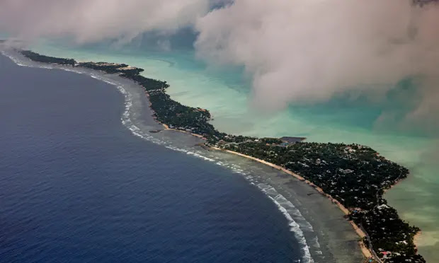
 Within decades, archipelagos could lose outlying atolls that define national borders as coastlines are increasingly threatened by storm surges. Photograph: Jonas Gratzer/LightRocket/Getty Images


Small island nations would rather fight than flee, but rising sea levels have prompted apocalyptic legal discussions about whether a state is still a state if its land disappears below the waves.

The Pacific Islands Forum, which represents many of the most vulnerable countries, has invited international legal experts to consider this question and begun a diplomatic campaign to ensure that political statehood continues even after a nation’s physical fabric is submerged.

At the heart of this discussion is the scientific certainty that oceans will continue to rise for at least another century and a sense of injustice that those worst affected are among the least responsible for the climate crisis. The Alliance of Small Island States represents more than a quarter of the world’s countries, but is responsible for less than 1% of global carbon emissions, most of which come from big industrialised countries in the global north.

This has locked in an expansion of the world’s oceans that is already under way and will accelerate in the second half of this century. Island maps are already being slowly redrawn and coastlines are increasingly threatened by storm surges. Within decades, archipelagos could lose outlying atolls that define national borders. A century from now – if not sooner – entire states could become uninhabitable, raising doubts about what will happen to their citizens, governments and resources.


 The World Bank had said current regulations on these matters were drawn up in a period of climate stability and may need to be reassessed to account for an “unprecedented situation for international law”.


At a conference on this topic in Fiji this year, the prime minister of the Cook Islands, Mark Brown, framed this debate in a series of existential questions: “As our shorelines are eaten away by sea level rise, what will become of our sovereignty, of our lands, our titles, our homes? What will become of our fundamental rights and freedoms guaranteed by our constitutions and the Universal Declaration of Human Rights? How can we realise our shared vision when our very status as ‘states’ is being questioned? How can we fulfil our responsibility to our peoples if their homes and livelihoods are taken away from them? These questions are difficult but real. They require solutions.”

Simon Kofe, the foreign minister of Tuvalu, one of the most vulnerable nations, stressed the need for a redefinition of global rules and a recognition of what is due to citizens of the worst-affected countries. “The threats of sea level rise and the erosion of our statehood are not mere hypotheticals, but very real and present dangers that we must face head on,” he said. “Our discourse is not limited to legal instruments and policies, but encompasses the survival of our people and nations. We have the power to make a significant impact by acting urgently and decisively.”


The priorities for action are largely determined by the timing of expected impacts. The science of sea level rise is well established, but there are several uncertainties related to future levels of greenhouse gas emissions and the speed at which the Greenland and Antarctic ice sheets melt.

Robert E. Kopp, an earth sciences professor at Rutgers University in New Jersey and one of the lead authors for the IPCC report on global sea level rise, said that a country like Tuvalu – which has an average elevation of 2 metres – was unlikely to be completely flooded until the 22nd century. The possible collapse of the giant Thwaites glacier in Antaractica could bring that forward as it would add 1.5 metres to ocean heights, but this would take decades. The more immediate risk, he said, was from storm surges: “It’s not just sea level rise, but when a place gets flooded multiple times a year.” This view was echoed by Peter Girard of Climate Central, who said floods would hit long before total inundation: “It could become impossible to live along the coast without protection.”

Tuvalu and other island states have recently begun reinforcing some of their coastlines with concrete flood barriers, but these are only a partial defence that will diminish over time and always be vulnerable to tsunamis or other big flooding events, as well as to upsurges of groundwater.

Faced by these threats to the integrity of the nation, protection of legal rights is a priority. In 2020, the Pacific Islands Forum called for international guarantees of existing maritime zones – and the resources within them – even if land territory is eroded.


More recently, Tuvalu has launched a diplomatic push for other nations to recognise its statehood regardless of the physical impacts of climate change.

Kofe noted that the definition of statehood under international law was reflected in the Montevideo convention, which sets out four criteria: a physical territory, population, government, and the capacity to enter into relations with other countries. “If we were to take that definition, Tuvalu could possibly lose its status as a state if we lose our physical territory or we are forced to relocate to a different location,” he said. “So we are just imagining this worst-case scenario – if it does come to that, we would want the world to continue to recognise our statehood as being permanent.”

So far, seven governments have made this commitment: Venezuela, the Bahamas, Saint Kitts, St Lucia, Vanuatu, Niue, Palau, Gabon and Taiwan. Tuvalu is also discussing the matter with bigger neighbours such as New Zealand and Australia.

Tuvalu is also digitising its government to make it easier to relocate, while legal scholars have considered whether statehood could be continued by leasing land in another country.

Patricia Galvão Teles, a member of the International Law Commission who participated in the conference in Fiji, noted the historical precedents of governments in exile during wartime, or the historical relocations of the Holy See and the Sovereign Order of Malta.

However, in those cases, the moves were temporary and away from a homeland that remained physically intact. A state that evacuates because of climate pressure may find it harder to prove its long-term viability if its land is under ever more water. The loss of productive land and other economic resources might also make it difficult to meet international obligations to protect the assets of its citizens, maintain embassies or pay for membership of global organisations.

Another challenge is whether a population could maintain its legal rights and cultural cohesion as a permanent diaspora. Galvão Teles noted that international law does not have a special legal category for climate refugees or people affected by sea level rise, so it is necessary to rely on existing agreements on human rights and refugees. If states can continue as political entities regardless of the physical loss of land, she said, the question of statelessness would probably not arise until “much further down the road”. However, there could be complications if people evacuate to another nation that does not allow dual citizenship or the registration of births of foreign nationals.

One solution, raised by the World Bank, would be to merge with another state, as Zanzibar and Tanganyika did in 1964 to form Tanzania.

Delegates at the conference said speculation about a landless state and stateless citizens should not distract from the more pressing task of persuading big emitters, such as the United States, Europe, China and India, to cut greenhouse gases, which was the most effective way of reducing pressure on the oceans.

Galvão Teles said the delegates at the Fiji conference wanted to counter the narrative of climate refugees and disappearing nations. “The new initiative is one of ‘rising nations’ and the message is, ‘We are not drowning, we are fighting,’” she said. That meant more emphasis on making industrial nations take responsibility for the problem and reduce emissions. “If you concede you will disappear, there will be less engagement on mitigation and adaptation measures,” she said.

Henry Puna, secretary general of the Pacific Islands Forum, stressed that climate action was the best chance for small island nations to guarantee their rights and their survival. “We must not lose sight of the bigger picture,” he said. “Ensuring that we keep [rises in] global temperatures below 1.5 degrees Celsius must always remain a top priority for us.”


Wildfire now nine miles from French city of Bordeaux, mayor warns

  Firefighters in Gironde are facing an "unprecedented" situation as they battle a blaze that "has a life of its own", ...